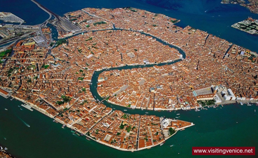
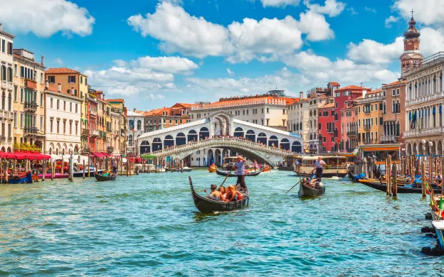
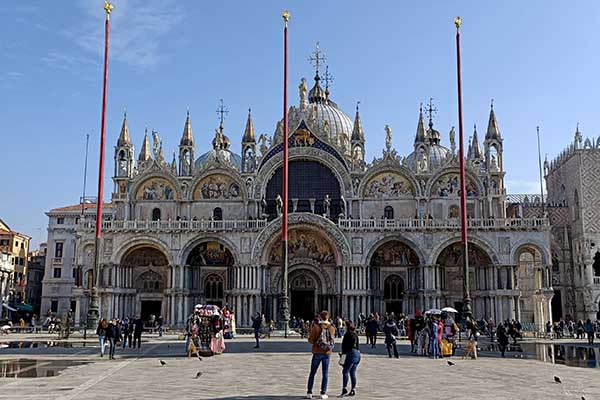
I am planning on booking a River Cruise in October 2026 – everyone is welcome. It starts and ends in Venice. Departure date is October 4th and it ends on October 11, 2026.
This will include all the enchanting beauty and history of Venice and Northern Italy. Janeen and I have been to Venice a couple of times but there is a lot to take in and this trip highlights both Venice specifically and some of the surrounding locations of the Veneto.
If you are interested, please contact Jessica Causer at MaCabe World Travel (same person as the Christmas Market Cruise) at 703-762-5053 or via email at jcauser@mccabeworld.com. There is a group discount of $300pp off, $150pp if you have travel with UniWorld in the past and 10% early booking discount but this expires June 30, 2025 so I encourage you to reach out to Jessica for more information.
If you have any questions I can answer, please do not hesitate to reach out.
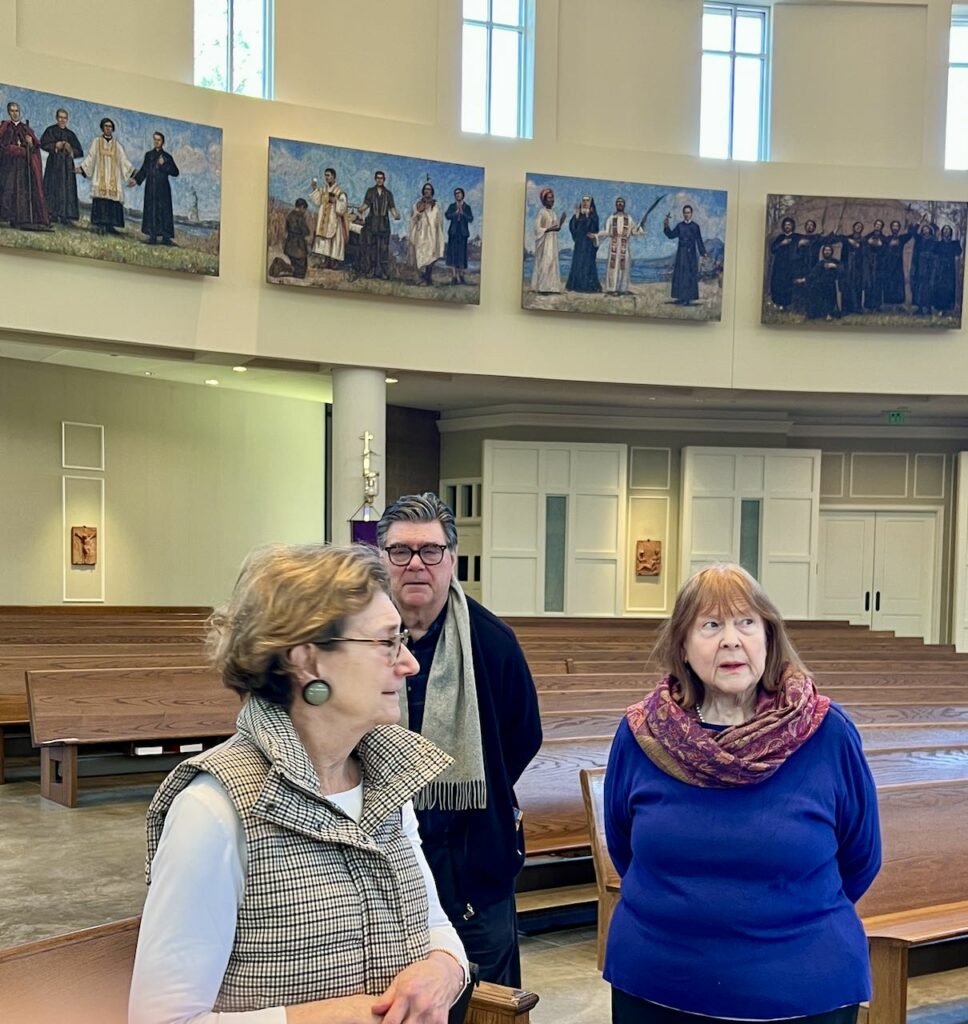
Over our travels, we have visited a number of churches and cathedrals all over Europe, even some in other foreign lands but we found a treasure right here in our back yard. Last fall, Elaine Ruffalo, who does weekly presentations on art throughout Italy, did a presentation on artist, Angel Ramiro Sanchez and his work. Sanchez was born in Venezuela and came to Florence in 1993 where he enrolled in the “Accademia di Belle Arti” and the “Florence Academy of Art” and has made a home for himself in Florence.
The presentation included his work on a major installation happening about 8 miles from our house at Saint Bede Catholic Church in Williamsburg VA entitled “Saints of the Americas in Worship Around the Altar”.
The artist working on the first panel in the series
Two members of the church, both with deep roots into the Italian art world, John and Michele Spike, were quite aware of Ramiro’s work and with their involvement and understanding of what the project might entail, recommended him to the pastor at the time Monsignor Timothy Keeney. This is a massive project with the intention of creating 34 mosaics that will be installed in the circular nave of Saint Bede Catholic Church. Comprised of 34 separate panels (each 5 feet x 8 feet) but comprising one piece of art the installation was part of the original plan for the church.
The Central theme, Saints of the Americas in Worship Around the Altar, gave some basis for the individuals that would be represented. With input from a group of parishioners, who were interested in the project, suggestions were made and general themes presented. This masterpiece will eventually depict 116 Saints, Venerables, and Blesseds from across the Americas—spanning Canada to Argentina—alongside 50 additional Saints, weaving a rich tapestry of devotion and history. Angel Ramiro Sanchez, who also serves as the Director of Advanced Painting at the Florence Academy of Art, is collaborating with master mosaicist Manrico Bertellotti from Barsanti Marble Bronze Mosaic in Pietrasanta Italy to bring this vision to life. With both the artist and the mosaic craftsmen living in Italy, it makes coordination of the overall project quite a challenge.
Panels 1 – Revered Parish Saints, : St. Stephen, St Lucy of Syracuse, St. Dominic, St. Sebastian, St. Cecilia, Panel 2 – The North American Martyrs: Set Jean de Lalande, St Isaac Joques, St Rene Goupil Panel 3 – Saints & A Blessed of the USA; St. Mother Theodore Guerin, St. Kateri Tekakwitha, St Katharine Drexel, St Rose Philippine Duchesne, Bl. Father Solanus Casey and Panel 4 – Saints of the USA:St Elizabeth Ann Seton, St Frances Xavier Cabrini, St Father Junipero Serra
Panels 5 – Saints of the USA; St John Neumann, St Damien de Veuster of Molokai, St Marianne Cope , Panel 6 – Patron Saints of Students & A Servant of God: St Stanislaw Kostka, St. Aloysius Gonzaga, S.D. Francis J. Parater, St John Berchmans, Panel 7 – Venerables of the USA; Ven. Father Nelson Baker, Ven, Mother Mary Magdalen Bentivoglio, Ven. Cornelia Connelly, Ven. Bishop Frederic Baraga and Panel 8 – Ven. Mother Mary Angeline Teresa McCory, Ven. Henriette Delille, Ven. Bishop Alphonse Gallegos
The timeline from idea to installation is dependent on the funds raised by the Church and the mosaicist schedule. Once Ramiro has completed the painting reflecting the specific portion of the work, it then falls back to the parish to ensure funds are available for completion of the mosaic and installation. Once funds have been confirmed, the artist makes a full-size cartoon that will be used by the mosaicists to create the work. Once the cartoon has been delivered to the mosaicist, it takes about 2 months to complete each panel.
This reflects the number of pieces that were needed to create panel 22 – Revered Parish Saints. It is a complicated jig saw puzzle.
Once all the pieces have been placed on the backing board, it is ready to be installed.
Once the panel has been completed, it is shipped to the Church in sections and the mosaicist are come from Italy to do the actual installation of the panel and get it placed along the wall in the Church. Currently there are 8 panels remaining to be designed and fabricated. It is anticipated the entire installation will be completed July of 2026.
John and Michele Spike along with Janeen
Sam Samorian (key player at the Church) John, Janeen, Michele and David
Viewing the current installation is just amazing. From a distance the panels look like paintings. It is only as you get closer to them you realize there made of thousands of individually placed pieces of mosaic tile.
This is a section of panel 2 – the image is Saint Isaac Jogues
This gives some idea of the range of colors used to create the panels
It is noteworthy that the orientation of the panels flows beginning with panel 1, to the right of the organ as you face it, and continuing through panel 34, left of the organ.
A close up of panel 23 -Saints of Ecuador – St. Miguel Febres Cordero, St. Maria Bernarda Butler, St Mariana Jesus de Paredes, St. Narcisa de Jesus
Also, as you look closely at the panels, you see that the background changes from dawn, to daylight, to dusk, to night, and back to dawn following the actual path of the sun with the orientation of the church.
Should you find. Yourself in the area, and have a desire to see this fantastic installation, check out the Church Website to see their opening times and other activities that might be happening. At the welcome Center, in the church Commons, there is a brochure available that will help navigate the individuals depicted including a QR code you can scan to view the biographies and additional images and vides of the process.
It is well worth the time to discover this wonderful installation of work being done.
The number of activities and places to go on the QM2 is staggering. Each evening we would get a copy of the Daily Program which highlighted what was happening the next day. Additionally, there was a theme during the cruise – Film Festival at Sea in partnership with BFI (British Film Institute). There were lots of activities in support of this special event including workshops, special screenings, discussions and lots more. Additionally, there were classic movies on the stateroom television, so lots of movie entertainment available.
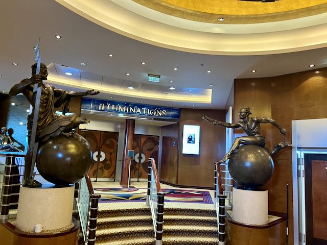
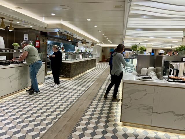
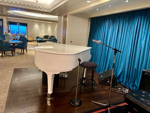
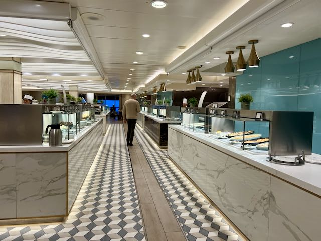
IlluminationsKing Court BuffetWonderful Piano Bar
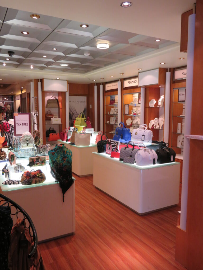
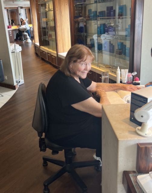
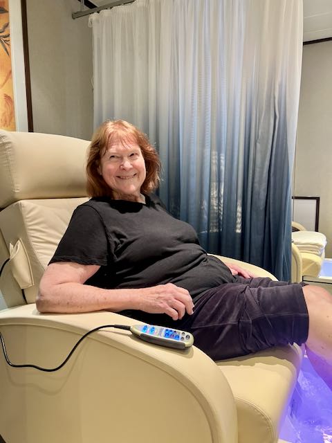
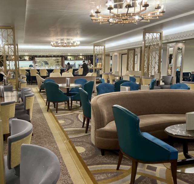
Of course, there were lounges to relax, various board games set up, entertainment (piano in the bar lounge, nightly shows in the main show room) and lots of other activities to keep you busy. If you ever got hungry, there were 5 different restaurants and food and beverage in 6 different lounge areas. We took advantage of the excellent Spa services for a manicure and pedicure. Shopping? Did I mention there were a number of high-end shops on the ship? And, of course, a casino. Fortunately, we weren’t into shopping or losing our money so we didn’t spend a lot of time in those areas.
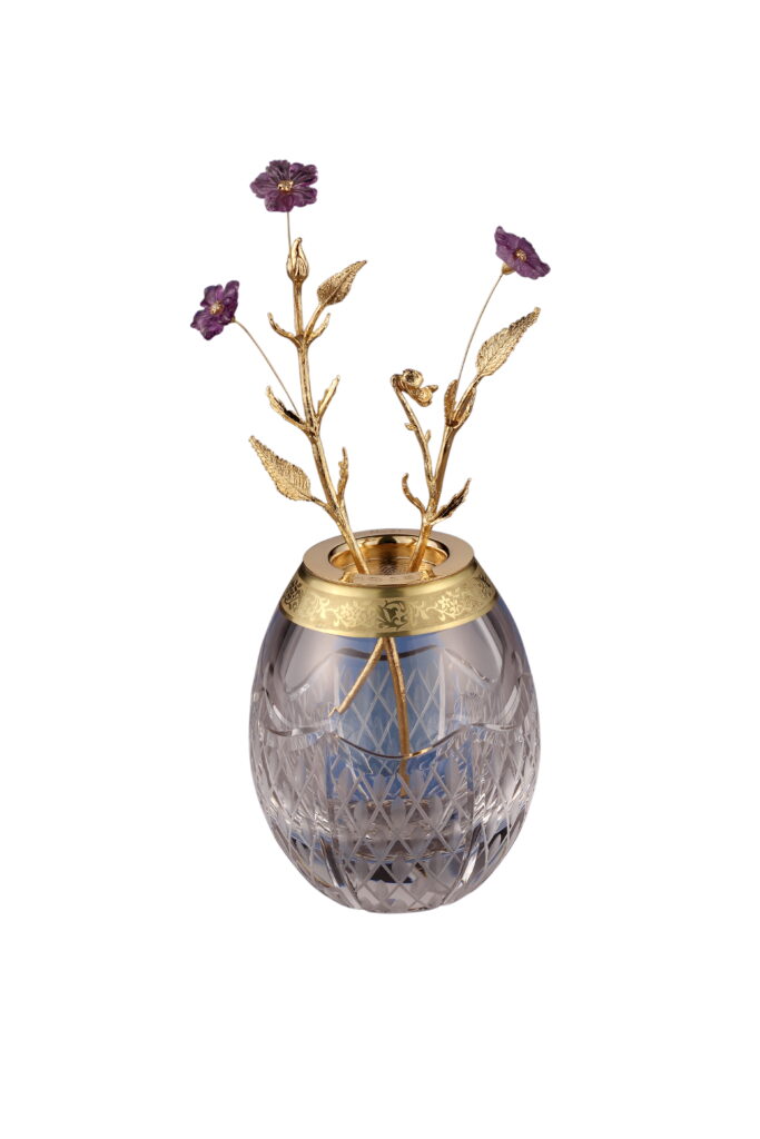
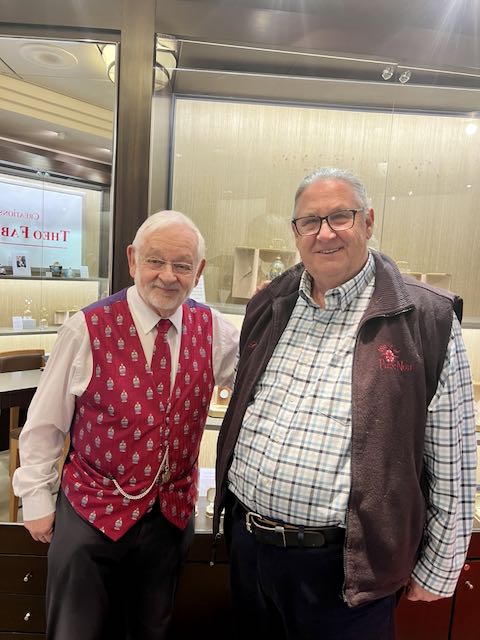
Janeen getting her Manicureand her pedicureTheo Faberge Egg, Tremblant Violet – this came home with us.Philip Birkenstein – Theo Fabergé St Petersburg Collection
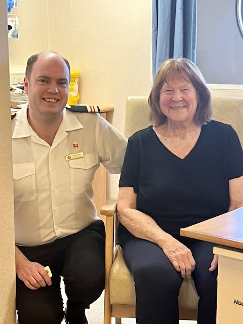
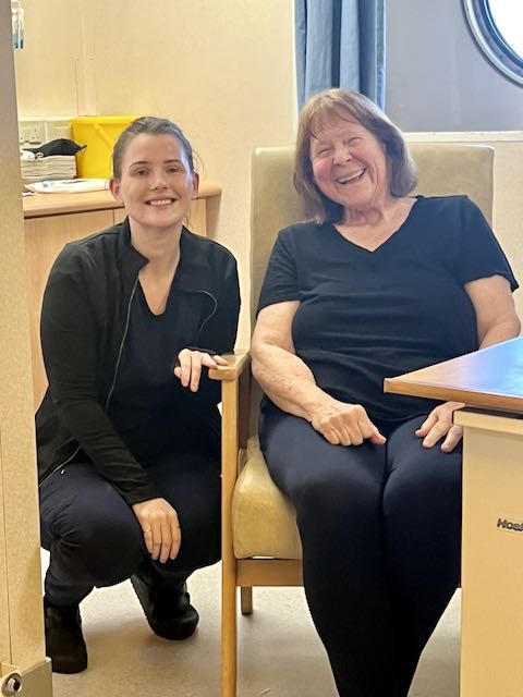
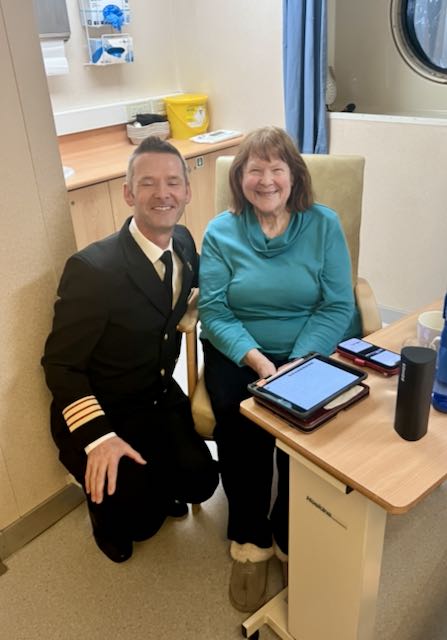
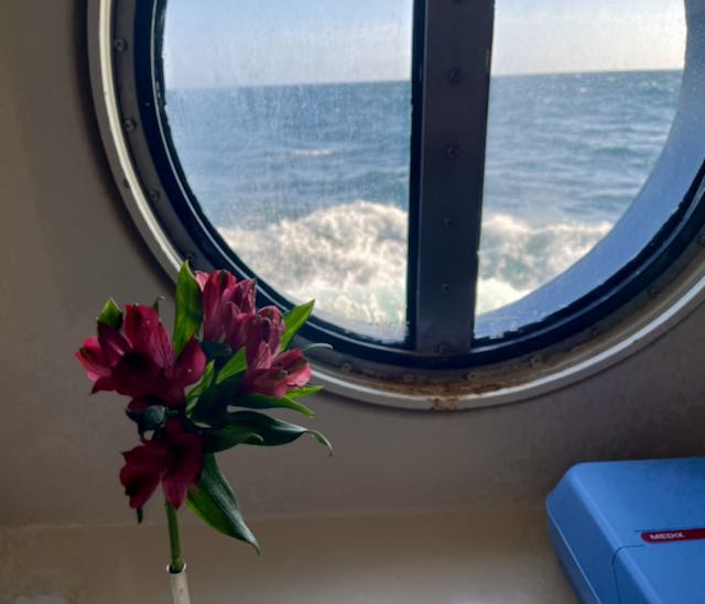
Janeen had an opportunity to get to know the Medical Clinic staff – and they were all wonderful and very caring group of people. Much thanks for all of their care and attention during her visit.
On the whole, it was a very relaxed crossing the seas were relatively gentle: there were a couple of nights of rock and roll but even that wasn’t significant really. Would I do it again? Absolutely! It was a very relaxing way to come across the Atlantic.
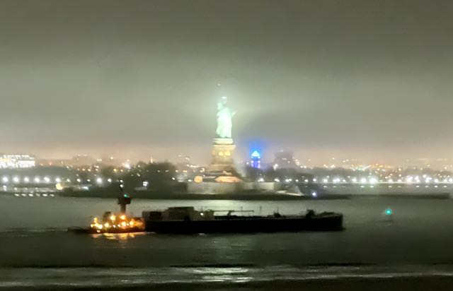
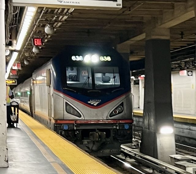
Once we arrived in NYC on QM2, we took a train from Moynihan Train Hall at Penn Station to Williamsburg. A train ride of 7 hours and multiple stops, but we didn’t have to change at any point which was wonderful.
As mentioned in the previous blog, we had been in Europe for the better part of almost 6 months. During that time, we visited 14 countries (France, Malta, Croatia, Montenegro, Italy, Greece, Tunisia, Monaco, Spain, Switzerland, Germany, Egypt, Belgium and the United Kingdom). During this time, we took 13 different flights, travelled on planes, ships, river boats, buses, cars and trains and covered a lot of miles as a result.
Our train arrives
In looking back, over the last year, in addition to the 14 countries visited on this time in Europe we also visited 7 countries last year (Argentina, Brazil, Uruguay, The Caribbean, Saint Vincent, Barbados and Antigua) when we were in South America! It seems we like to travel as we have been away from our home in Williamsburg over 60% over the last 12 months. What does the future hold you might ask? Well, we have a trip on Oceania from Boston to Montreal and going to Los Angeles after this cruise in October, a Jazz Cruise in the Caribbeanin in January and a round trip cruise from Los Angeles to Australia planned for Mid-March to the first part of April next year. There is always the possibility of additional travel opportunities for sure.
Stay tuned, leave a comment, let us know what your travel plans are maybe we can connect somewhere in the wonderful world.
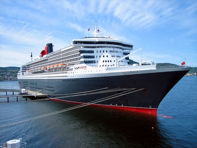
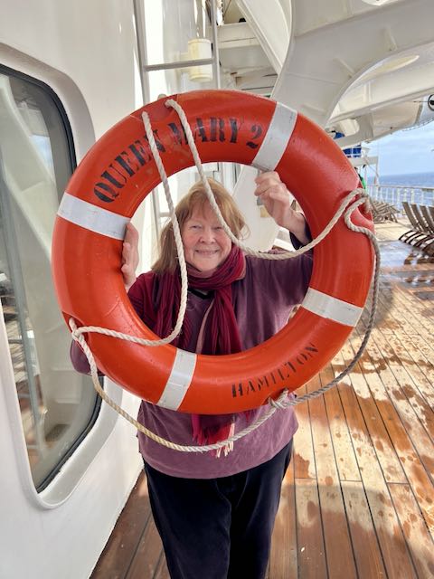
For the better part of 6 months, we have been traveling in Europe. It’s now time to figure out how to get home and rather than fly we have booked passage on The RMS Queen Mary 2 (RMS means Royal Mail Ship). The QM2 has served as the flagship of the Cunard Line since April 2004, and as of 2025, is the only active, purpose-built ocean liner still in service. Queen Mary 2 sails regular transatlantic crossings between Southampton and New York City, in addition to short cruises and an annual world voyage.
The original RMS Queen Mary had been active doing the same route from 1936 to 1967 when she was retired and eventually found her was to Long Beach California where she is a floating hotel, museum, and convention space. We had been on board this ship a couple of times over the years so it was fun to schedule our passage on the QM2.
Our Ferry The Lounge at the front of the ship
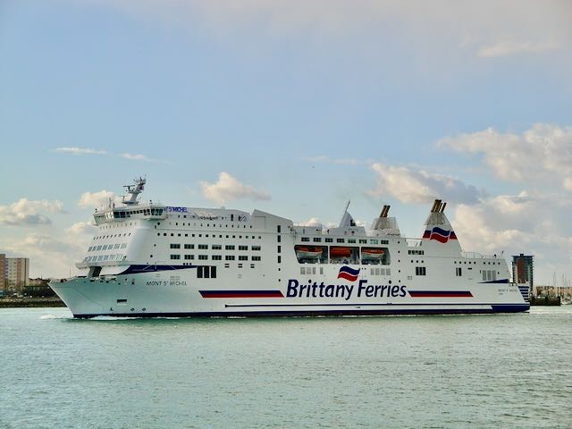
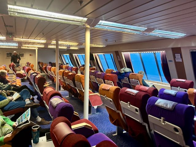
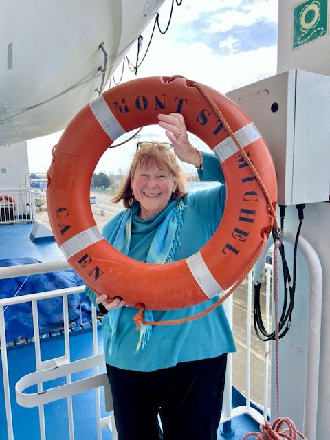
Ryan coordinated our passage via ferry from Caen France to Portsmouth UK where we took a taxi to our hotel the night before sailing. The Ferry was easy – large ocean-going ship with lots of lounge space and various restaurants. The lower decks carried cars, semi-trucks and other vehicles while the upper decks were all for passengers. Our seats were in the forward lounge with large seating overlooking the bow. Fortunately, the two or three school groups that boarded with us were all in separate areas. There were also several duty-free shops on the ship offering various products including a fairly nice selection of wines. The entire trip took about 5 hours but we had smooth sailing throughout the trip.
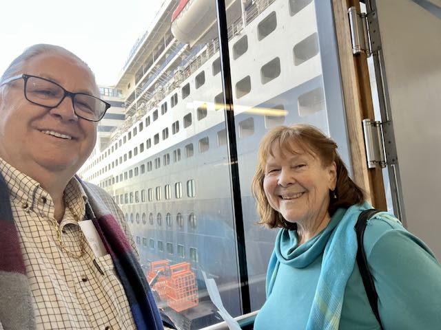
Our first look at the QM2 was from our hotel room – looking out across the harbor in Southampton.
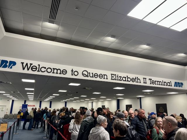
Once through the check in process, which went surprisingly quickly, we started to explore the common areas of the ship and found a place for a bite to eat.
At the time of her construction, QM2 was the longest, at 1,131.99 ft, and largest passenger ship ever built. Queen Mary 2 has a maximum speed of just over 30 knots (35 mph) and a cruising speed of 26 knots (30 mph). Instead of the common diesel-electric configuration, Queen Mary 2 uses integrated electric propulsion to achieve her top speed. Diesel engines, augmented by gas turbines, are used to generate electricity for electric motors for propulsion and for on-board use. The ship can take as many as 2,695 passengers supported by 1,253 crew – about a 2 to 1 ration (smaller than the crew ration on Oceania…)
Minolta DSC
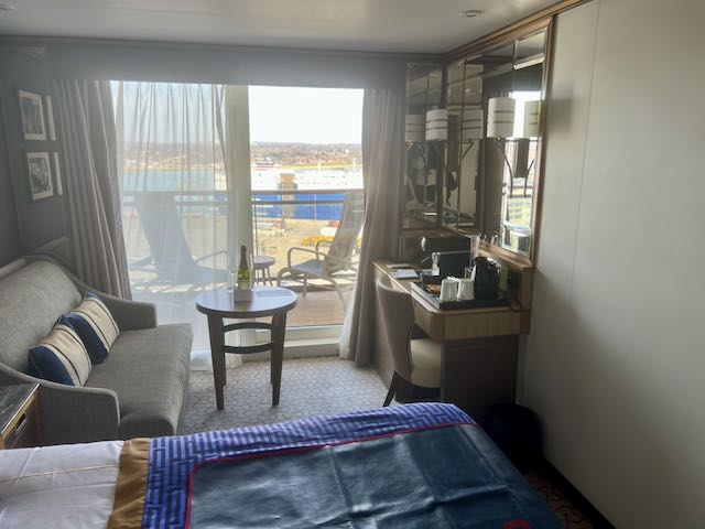
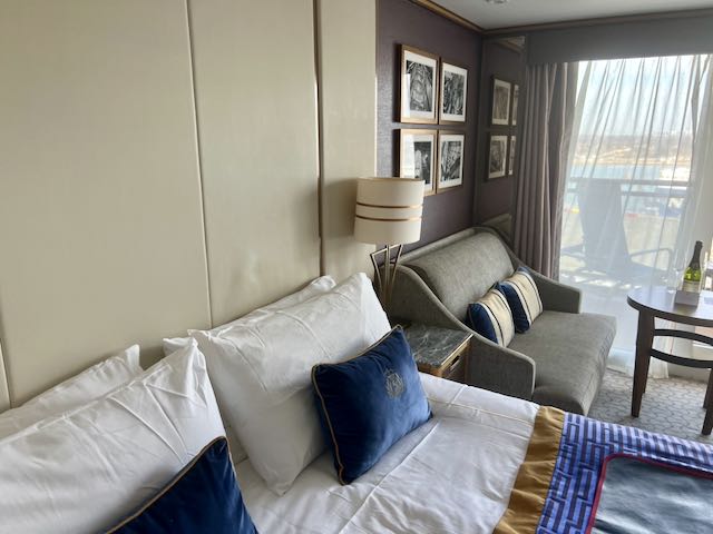
Our cabin was on the top deck – 13 – all the way forward. It’s a nice cabin with generally good amenities. Being at the top of the ship has some disadvantages, however, as we get more motion as a result.
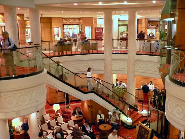
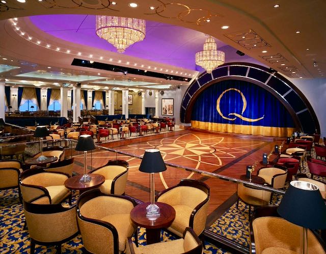
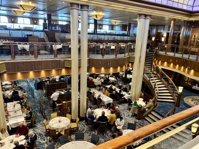
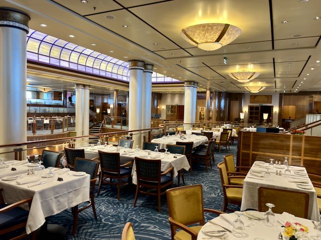
Our first day was focused on getting situated into our cabin and getting a general ‘feel’ for the ship. There are clearly a lot of areas to explore! Queen Mary 2’s facilities include fifteen restaurants and bars, five swimming pools, a casino, a ballroom, a theatre, and the first planetarium at sea. Of course, there is the shopping area with some very expensive shops ready to take our cash any time!
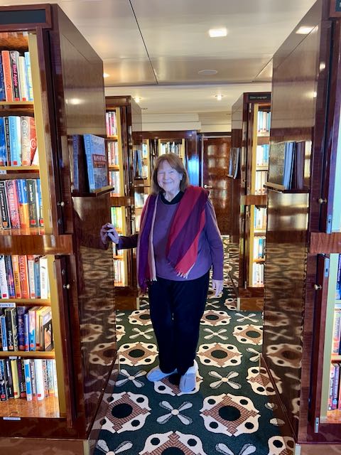
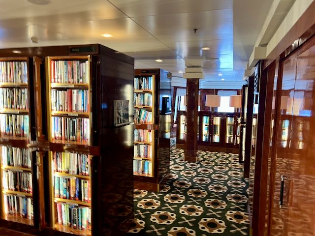
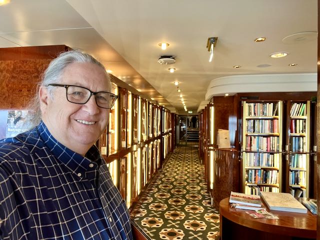
A large library with lots of books, computer stations and a nice space to just sit and read
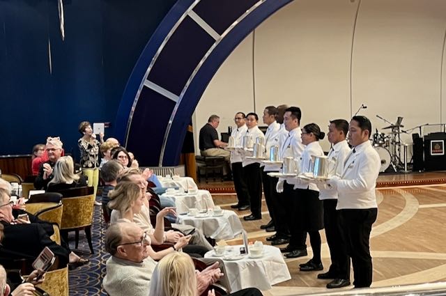
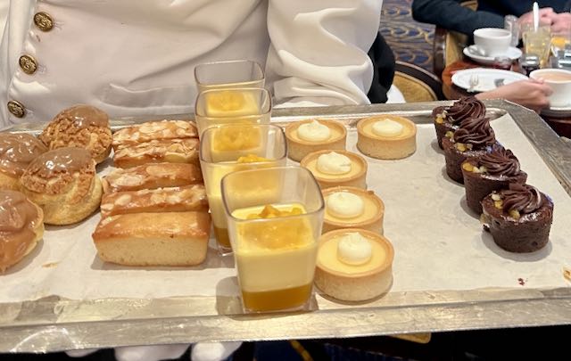
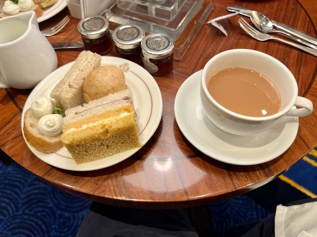
Each afternoon there is a High Tea. A wonderful experience with lots of tea and finger food.
Way to much to report in only one blog…more to come!
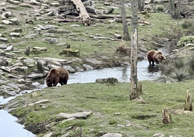
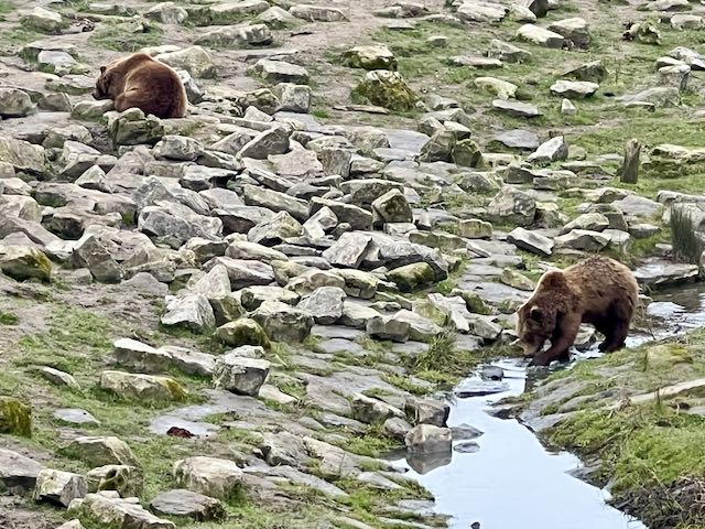
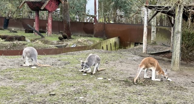
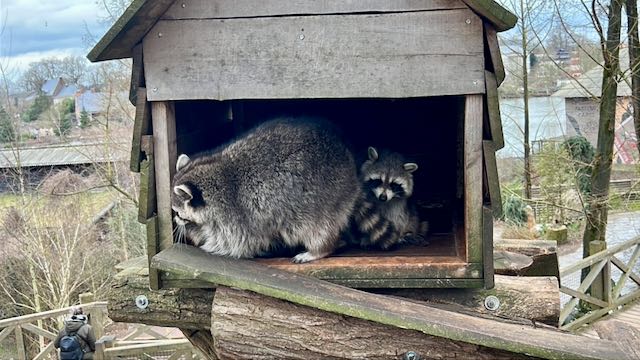
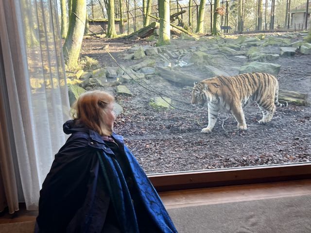
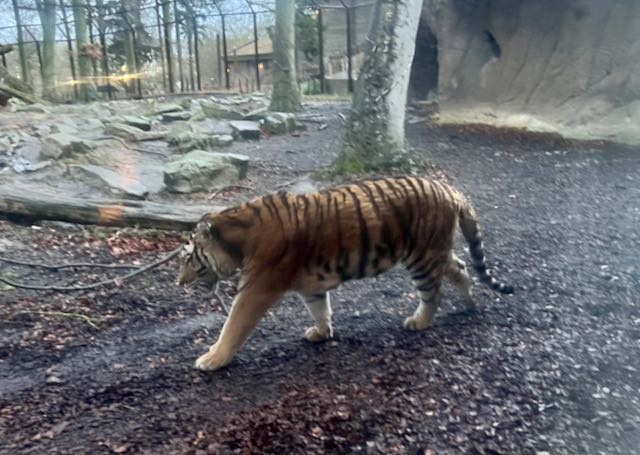
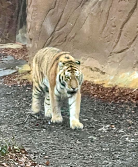
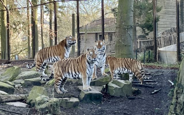
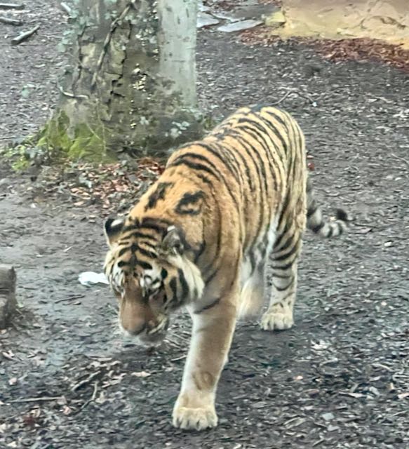
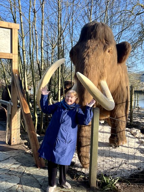
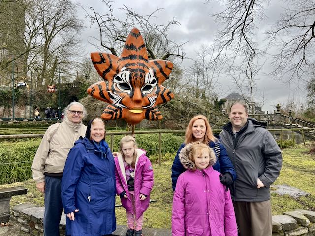
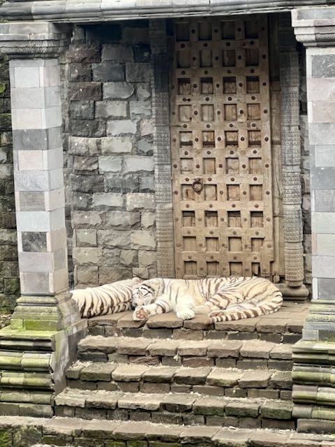
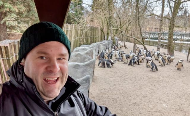
Over the years, we have been to any number of zoos around the country. Most recently, we visited the Pairi Daiza Resort – a very different kind of place near Brugelette in Belgium. Yes, there are a variety of animals, but we stayed in an apartment with windows directly out to the enclosures. The first night we stayed next to the Sea Lion area while the second night we had a window into the Tiger enclosure. Both locations were fantastic!
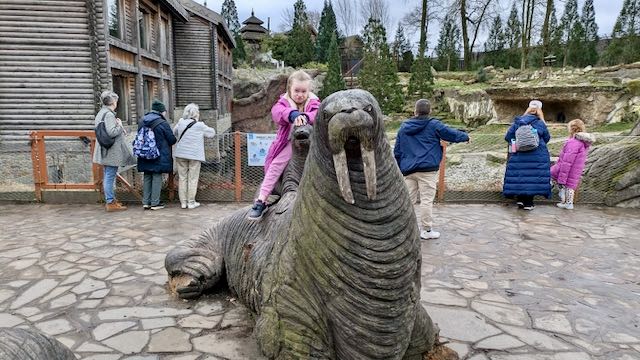
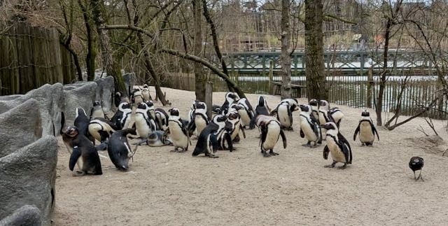
Pairi Daiza is organized representing five continents to reflect the origins of the animals in those areas. It is a very large place with more than 7,500 animals in spacious habitats including Giant pandas, elephants, polar bears, orangutans, rare birds, gorillas, walruses; more than 800 species are protected in the Park. Awarded “Best Zoo in Europe” it is also certified “Three Stars” in the Michelin Green Guide.
We arrived late in the evening and arrived just prior to their closing of the dining room (room reservations include both breakfast and dinner) which was fortunate. The first night, staying next to the Sea Lions we didn’t really appreciate what we could see. In the morning, it was clear the Sea Lions were active, as they kept barking!
Our second night was overlooking the tiger enclosure and we had some nice close encounters.
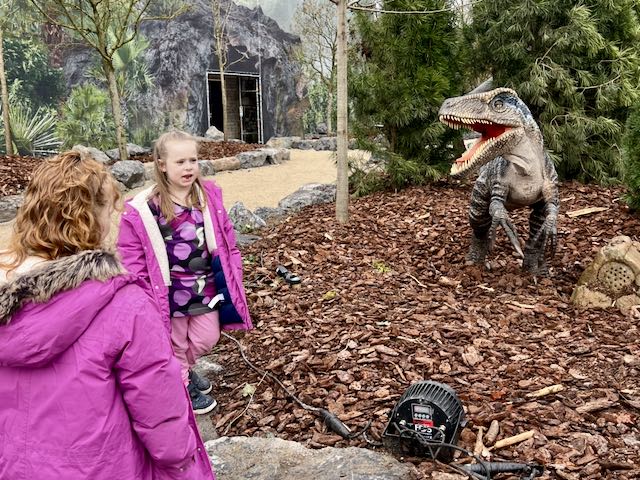
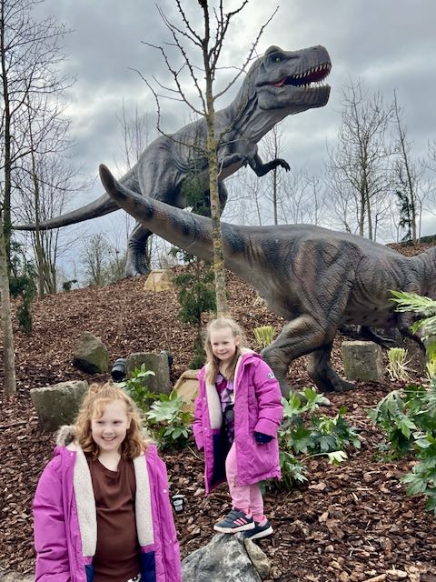
After buffet breakfast we toured around and one area in particular was quite fun. They have put in world where dinosaurs dominated the Earth. This unique exhibition had a bunch of them animatronically moving around, roaring and generally showing off. Our 5-year old grand girl really enjoyed this area for sure.
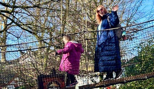
At one point, my grands and their mother went over the suspension bridge – this bridge was quite long and went over several different animal enclosures. They were all very brave!
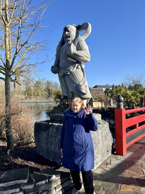
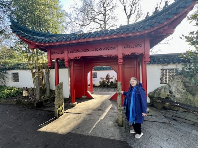
Janeen particularly liked the entrance to the Chinese Garden – very similar to that at the Huntington Gardens in San Marino (CA) where she u volunteered in the Herb Garden. Called the Middle Kingdom, it’s filled with magnificent gardens and architecture.
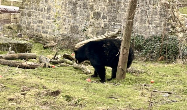
The Chinese Garden, the largest in Europe, is home to Giant Pandas (not on display due to the weather) Asiatic Black Bears, Red Pandas, Snow Leopards and many others.
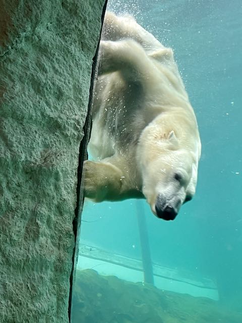
Polar Bears have a wonderful space – and you get to see them up close as they swim by!
Turns out that during our visit several areas have been a transformed into a festive and colorful atmosphere with 9 giant masks creations, as well as the enchanting decorations. This all to celebrate Carnaval.
The following morning was clear and beautiful and we wandered around some more and enjoyed the exhibits and scenery.
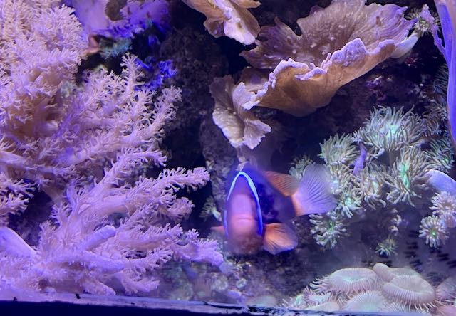
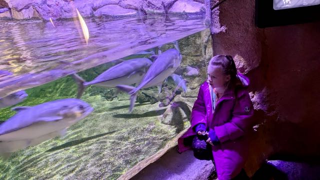
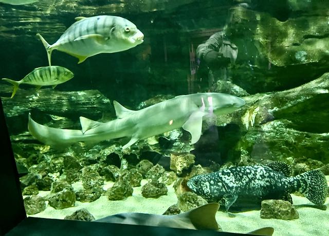
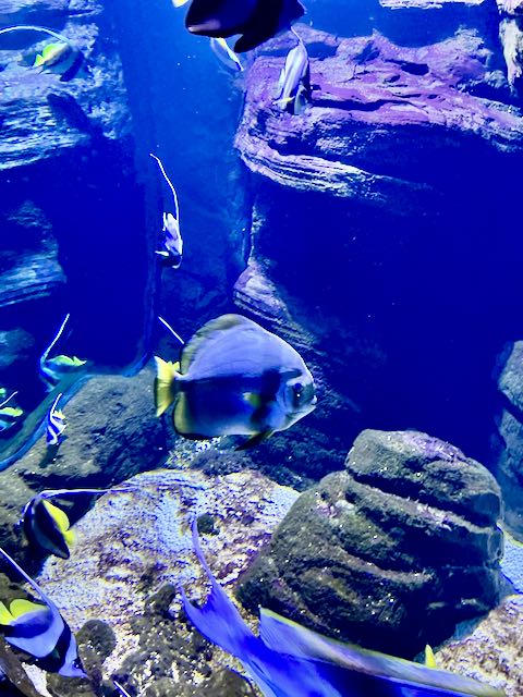
There is a large building with a walk through aquarium with an abundance of different tanks filled with fish!
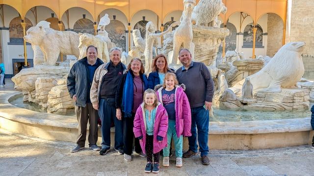
Just before lunch, our youngest son Ryan, joined us and we all celebrated his birthday.
Once that was done, we transferred all our stuff from into his car and continued our Adventure in France. Stay tuned, more to come!